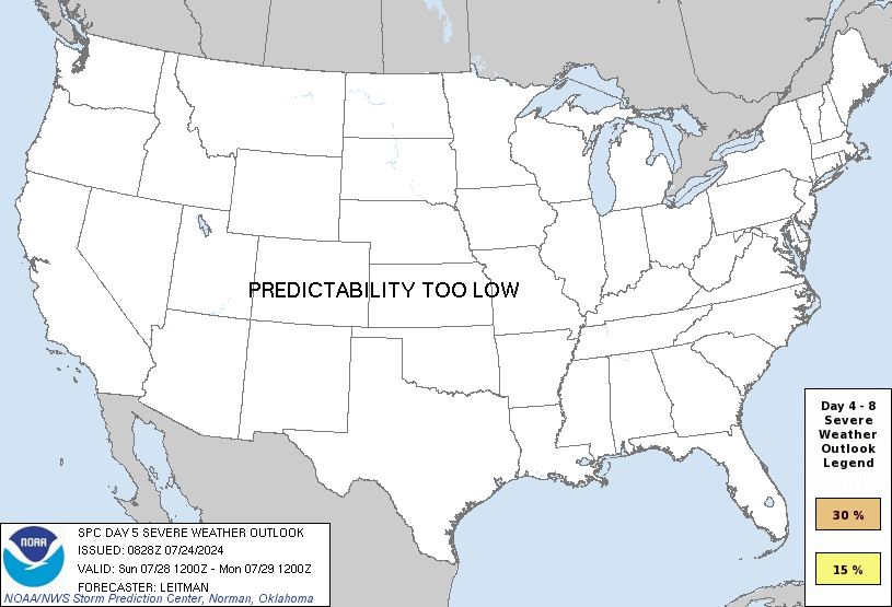
• Welcome to TalkWeather!
    We see you lurking around TalkWeather! Take the extra step and join us today to view attachments, see less ads and maybe even join the discussion.
    CLICK TO JOIN TALKWEATHER
  • April 2024 Weather Video of the Month
    Post your nominations now!

This severe weather season will be?

  • Above Average

    Votes: 7 31.8%
  • Average

    Votes: 13 59.1%
  • Below Average

    Votes: 2 9.1%

  • Total voters
    22
  • Poll closed .

MichelleH

Moderator
Moderator
Messages
914
Reaction score
1,386
Location
Cullman, AL
Tornado watch for parts of Louisiana until 5 pm.

http://www.spc.noaa.gov/products/watch/ww0003.html

ww0003_radar.gif
 
  • Thread starter
  • Moderator
  • #47

Taylor Campbell

Moderator
Moderator
PerryW Project Supporter
Messages
2,137
Reaction score
2,241
Location
Wedowee, AL
Special Affiliations
  1. SKYWARN® Volunteer
Don't sleep on next week either. We just need to get through this weekend first and then that'll be the primary focus.
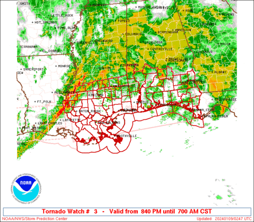
I agree! It has potential to be very interesting!
 

Mike S

Administrator
Staff member
Administrator
Moderator
PerryW Project Supporter
Messages
2,013
Reaction score
1,174
Location
Meridianville, Al
Special Affiliations
  1. SKYWARN® Volunteer
Euro control/ensembles, UKMET, and GFS are all nasty for next Wednesday/Thursday.

Eesh. We do seem to like our Wednesday storms around here.
 
Messages
2,855
Reaction score
4,645
Location
Madison, WI
500mb looks downright dangerous on the 12z and 18z GFS valid for 0z Thursday. Moisture is once again seasonably impressive but not much CAPE showing. Might be an issue with lapse rates again.
 
Messages
604
Reaction score
429
Location
St. Catharines, Ontario
I don't know what it is with MS/AL and Wednesday events, and I might just be biased after a long severe drought, but I'm eyeballing this one. Like Cheesland said, the main caveat seems to be limited CAPE at the moment.
 

Fred Gossage

Member
Meteorologist
PerryW Project Supporter
Messages
659
Reaction score
2,583
Location
Florence, AL
The 00Z Euro tonight initialized SBCAPE wholesale across the entire warm sector a solid 600-1000+ j/kg too low compared to the 00Z balloon soundings. That means it couldn't even correctly regurgitate what it ingested from the balloon data at 00 hrs. The 12 hr SBCAPE forecast for 00Z tonight from back on the 12Z run was even further off, and it's been wrong for days about this, over and over, run after run. Now, there's another system coming mid week (with a more favorable setup than this one for low-level moisture advection and mid-level EML advection), and the Euro is squashing its instability too, for the same INCORRECT reasons that it had low to no instability in the warm sector of this killer tornado event... and I'm supposed to just magically believe it? Nope, no thanks...

EDIT: And running trends in the NAM and GFS for the past few days, they have been consistently 5+ (in some cases 7+) degrees too low on dewpoints across the warm sector for tonight (and some of the runs have only gotten worse in comparison to reality, the closer we have gotten)...
 
Last edited:
Messages
2,855
Reaction score
4,645
Location
Madison, WI
Good analysis, Fred. I'm used to expecting the models to be over-bullish on CAPE, especially when they start showing 3,000+ j/kg for early season events, but perhaps their biases have changed? I wonder what the reason for this is?
 
Back
Top