

- Thread starter
- Moderator
- #41
Tornado warning southwest of Springfield, MO near Aurora. Very strong velocity returns, and a nice appendage.
Headed for the Springfield National Weather Service office.
Follow along with the video below to see how to install our site as a web app on your home screen.

Note: this_feature_currently_requires_accessing_site_using_safari

Tornado warning southwest of Springfield, MO near Aurora. Very strong velocity returns, and a nice appendage.
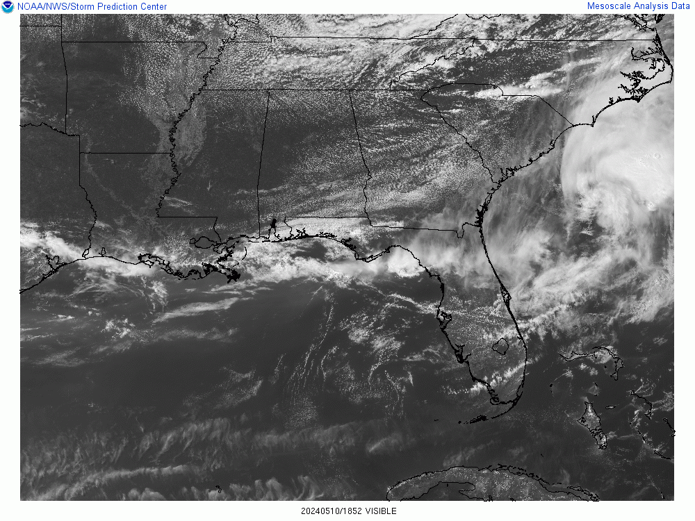
...Eastern AL/Western GA overnight...
Recent model solutions suggest that the favorable air mass over MS
will shift eastward into parts of AL and western GA overnight.
Scattered thunderstorms are expected to develop along the cold front
sagging into this area. A few CAM solutions suggest considerable
intensity to this activity, with supercells possible with a tornado
risk. Therefore, have extended the SLGT risk farther east into this
region.
..Hart/Bentley.. 12/01/201
for Bham? I don't see anything here before 3pm.How long is the "lull" expected to last before the storms fire up this afternoon? Trying to decide about going to town. Thanks! (sorry for the dumb question)
You are talkin about a ‘perfect storm’ worst case scenario for station managers & mets . It will be a true no-win situation.How will the CBS affiliates in south and central Alabama and Georgia handle the SEC Championship Game if there are tornado warnings in their coverage area during the game?
Leave the game on and if I go while watching the game, I just go.How will the CBS affiliates in south and central Alabama and Georgia handle the SEC Championship Game if there are tornado warnings in their coverage area during the game?
They did one at NoonSpann says NWS Birmingham about to do a special balloon launch shortly (if not already). This will give some better up-to-date info on the current atmosphere.

Typically it is the news director...but that is assuming they have an understanding with the GM.Re AKT1985's original question (post #43): Question for Richard or other TV met: Who makes the actual decision to do a program cut-in for a weather warning? I imagine the met makes the request to cut-in but who gives the permission to actually do so (program director, manager, etc?) Maybe it varies from station to station?
for Bham? I don't see anything here before 3pm.
Yep, much more sunshine than I expected plus the coastal convection has been centered more east than I was thinking.This is getting sneakily interesting across AL. Do NOT let your guard down this afternoon.. the airmass is recovering remarkably well behind the coastal convection (much better than I really expected it to) and if we get just enough forcing for a few isolated storms we could have some issues.
However, it does appear some subsidence has moved into Mississippi causing the storms there to weaken.Yep, much more sunshine than I expected plus the coastal convection has been centered more east than I was thinking.