

warneagle
Member
I definitely wouldn't sleep on S MN/N IA either. Some serious shear values between the Twin Cities and Des Moines.


That might actually serve to mix out dew points.....Significant clearing (perhaps more than expected) showing up on visible satellite over W and C IA, SW MN, NE KS and NW MO.
Tornado on the ground headed for Oak Grove, MO.
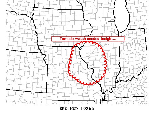
Honestly I think this setup has everything going for it except for somewhat sub-ideal moisture trajectories due to that pesky ridge centered just off the Atlantic coast, and wind profiles a little more parallel to the cold front that I would like to see across the northern end of the threat. Still, I think the potential is there for widespread wind and hail from Iowa to Oklahoma, with 1 or 2 potentially dangerous tornadic supercells primarily over E KS or W MO. This event could approach, but probably not match or exceed, last Tuesday in magnitude. Following severe weather over the last few years, I've become a big fan of lapse rates/cold air aloft.
Northern AR/SW MO is about to get ugly I regret to say
Absolutely excellent forecast there. Gonna have to see how things evolve over SW MO/NW AR but you have nailed it.