- Thread starter
- #321
The only news is that Magnus Tumi said tonight, in a Visir interview, that this might go on a while.
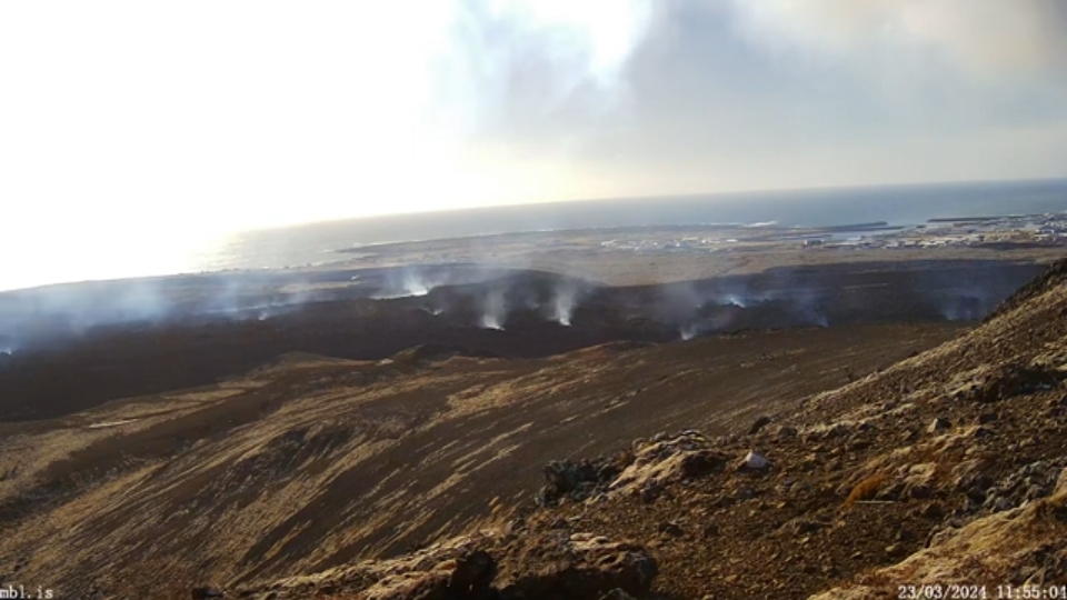
The fountains seem to be much the same as during this morning. The cam view is better, and RUV live update reports that scientists are taking advantage of the weather inprovement to do some gas and lava measurements.
They're measuring HCl, too, so they haven't ruled out an ocean entry eventually.
As I understand news articles, this new lava is running over the initial flows, not increasing those. Apparently the only movement in the older flows is some creeping toward the main road, which is still clear.
Workers at Hraun, closer to the sea, did get a barrier across the road (and of course everyone there got their valuables together and evacuated last night). That situation is stable for now, I guess.
No more news yet about Svartsengi deformation, one way or the other. Given the interview with Magnus Tumi this evening, my guess is that at least they don't see DEflation (which did quickly show up on the GNSS graphic after the last two eruptions).
This layperson speculates that whatever has changed down there will likely turn out to be related to Mount Thorbjorn's 20-cm dash westward last month.
But this whole thing is weird; don't have the figures in front of me right now, but I've read that, during the reportedly very similar Krafla Fires from 1975 to 1984, dike intrusions were many but only nine in total led to an eruption.
That ratio is close to the average for Iceland's rifting episodes (as the fires are called formally -- each dike intrusion/eruption is considered a rifting event.)
But here on the peninsula, eruptions have happened much more frequently.
I'm still reading and found this post (autotranslated) at the University of Iceland website, reviewing things from the 2019 seismic unrest through late February 2024.
Just an excerpt:
After reading the whole thing, it's hard to imagine anyone living full-time in Grindavik for years to come -- hope they get to keep using it as a port, though. Six thousand tonnes of Atlantic cod each year aren't going to harvest themselves (figure from an Iceland Review fact sheet).
The fountains seem to be much the same as during this morning. The cam view is better, and RUV live update reports that scientists are taking advantage of the weather inprovement to do some gas and lava measurements.
They're measuring HCl, too, so they haven't ruled out an ocean entry eventually.
As I understand news articles, this new lava is running over the initial flows, not increasing those. Apparently the only movement in the older flows is some creeping toward the main road, which is still clear.
Workers at Hraun, closer to the sea, did get a barrier across the road (and of course everyone there got their valuables together and evacuated last night). That situation is stable for now, I guess.
No more news yet about Svartsengi deformation, one way or the other. Given the interview with Magnus Tumi this evening, my guess is that at least they don't see DEflation (which did quickly show up on the GNSS graphic after the last two eruptions).
This layperson speculates that whatever has changed down there will likely turn out to be related to Mount Thorbjorn's 20-cm dash westward last month.
But this whole thing is weird; don't have the figures in front of me right now, but I've read that, during the reportedly very similar Krafla Fires from 1975 to 1984, dike intrusions were many but only nine in total led to an eruption.
That ratio is close to the average for Iceland's rifting episodes (as the fires are called formally -- each dike intrusion/eruption is considered a rifting event.)
But here on the peninsula, eruptions have happened much more frequently.
I'm still reading and found this post (autotranslated) at the University of Iceland website, reviewing things from the 2019 seismic unrest through late February 2024.
Just an excerpt:
The reason that the current activity is more dangerous than the activity at Fagradalsfjall is both its proximity to Grindavík, the Blue Lagoon, the power plant in Svartsengi and important infrastructure, as well as the much faster magma flow and lava flow. The reason for this is believed to be that the magma channel out of the Svartsengis magma area has a relatively large cross-sectional area, which enables a rapid flow of magma into the upper part of the earth's crust and to the eruption centers.
After reading the whole thing, it's hard to imagine anyone living full-time in Grindavik for years to come -- hope they get to keep using it as a port, though. Six thousand tonnes of Atlantic cod each year aren't going to harvest themselves (figure from an Iceland Review fact sheet).